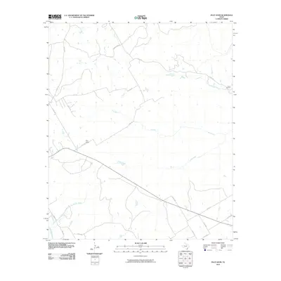
2010 Map of Pilot Knob
USGS Topo · Published 2010About this map
Cedron Creek and the North Bosque River anchor this rural landscape in Bosque County, characterized by a network of ranch roads and limestone-rich drainages. The area is dominated by the distinct elevation of Pilot Knob, a prominent terrain feature that likely served as a significant landmark for early travelers through this central Texas corridor. The mapping reveals a sparse but established settlement pattern, where life is organized around water sources like Toms Branch and Stanifer Branch. Local history and genealogy are centered at the Cedron Cemetery, situated near the eastern edge of the quadrangle. This 2010 survey documents the modern layout of rural infrastructure, including Farm Rd 1991 and numerous county routes like Gregory Ranch Rd, showing how modern access continues to follow the natural contours of the Bosque hills.
Find a feature on this map
22 named features on this map. Tap any name to fly to it.
Don’t see what you’re looking for? This feature index may not catch every label — zoom into the map to look around manually.
Map Details
Editions of this 2010 Pilot Knob Map
This is the sole edition of this map. No revisions or reprints were ever made.
Other maps of this area

1888 · Meridian
USGS Topo · 1:125,000

1889 · Granbury
USGS Topo · 1:125,000

1891 · Cleburne
USGS Topo · 1:125,000

1892 · Waco
USGS Topo · 1:125,000

1894 · Meridian
USGS Topo · 1:125,000

1894 · Cleburne
USGS Topo · 1:125,000

1920 · Waco
USGS Topo · 1:125,000

1924 · Waco 2-b
USGS Topo · 1:48,000

1924 · Cleburne 3-C
USGS Topo · 1:48,000

1927 · Blum
USGS Topo · 1:62,500