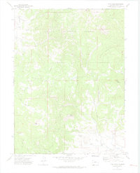
1971 Map of Pilot Knob
USGS Topo · Published 1974About this map
The Routt National Forest dominates this mountain landscape in Northwest Colorado, where prominent high points and deep drainages define the topography. The terrain is marked by the presence of the Anthracite Ridge and distinct peaks like Pilot Knob and Saddle Mountain. Settlement evidence is sparse, highlighting the area's history as a remote extraction and grazing territory. Of particular interest to local historians is the Deep Creek Cem located near the southern margin, and the Block Mine on the western slopes of Round Mountain. A network of Jeep Trails provides the primary access through the forest, connecting various springs and creek systems such as Armstrong Creek and Day Creek. The inclusion of a singular Drill Hole and specific rim formations like the Coleman Rim Rocks offers insight into the geological surveying and resource exploration active during the early 1970s.
Find a feature on this map
26 named features on this map. Tap any name to fly to it.
Don’t see what you’re looking for? This feature index may not catch every label — zoom into the map to look around manually.
Map Details
Editions of this 1971 Pilot Knob Map
2 editions found
Other maps of this area

1911 · Hahns Peak
USGS Topo · 1:125,000

1913 · Hahns Peak
USGS Topo · 1:125,000

1923 · Pilot Knob
USGS Topo · 1:62,500

1925 · Pilot Knob
USGS Topo · 1:62,500

1954 · Craig
USGS Topo · 1:250,000

1957 · Craig
USGS Topo · 1:250,000

1958 · Craig
USGS Topo · 1:250,000

1960 · Craig
USGS Topo · 1:250,000

1962 · Craig
USGS Topo · 1:250,000
1962 · Hahns Peak
USGS Topo · 1:24,000