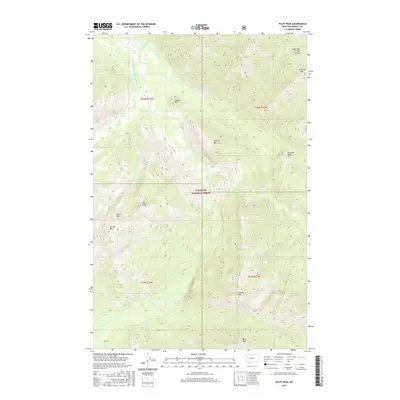
2017 Map of Pilot Peak
USGS Topo · Published 2017About this map
Flathead National Forest encompasses this wilderness area in Powell County, dominated by the high ridgelines of the Lewis and Clark Range. The drainage network is particularly complex here, where the South Fork Flathead River is fed by a series of significant tributaries including Cayuse Cr and Brownstone Cr. The landscape is a corridor of peaks and basins, defined by prominent summits such as Pilot Peak, Jumbo Mtn, and Scintilla Mtn. High-elevation features like Emerson Peak and Fossil Mtn overlook the winding courses of Youngs Cr and Danaher Cr. This 2017 survey reflects the modern management boundaries and hydrographic data of the region, providing a clear view of the undeveloped mountain terrain that has shaped the natural history of western Montana.
Find a feature on this map
24 named features on this map. Tap any name to fly to it.
Don’t see what you’re looking for? This feature index may not catch every label — zoom into the map to look around manually.
Map Details
Editions of this 2017 Pilot Peak Map
This is the sole edition of this map. No revisions or reprints were ever made.
Other maps of this area

1902 · Ovando
USGS Topo · 1:125,000

1905 · Ovando
USGS Topo · 1:125,000

1936 · Silvertip
USGS Topo · 1:96,000

1942 · Silvertip
USGS Topo · 1:125,000

1955 · Choteau
USGS Topo · 1:250,000

1957 · Choteau
USGS Topo · 1:250,000

1958 · Choteau
USGS Topo · 1:250,000

1962 · Choteau
USGS Topo · 1:250,000
1970 · Crimson Peak
USGS Topo · 1:24,000
1970 · Danaher Mountain
USGS Topo · 1:24,000