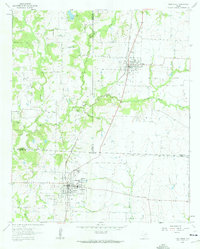
1961 Map of Pilot Point
USGS Topo · Published 1963About this map
Pilot Point and Tioga anchor this northern Texas landscape where the Texas and Pacific railroad facilitates the movement of goods through the borderlands of Denton, Grayson, and Cooke counties. The settlement at Pilot Point is particularly well-defined, showing a dense street grid supported by educational and spiritual institutions such as Gee High Sch, Washington Sch, and Bible Chapel. To the north, the smaller community of Tioga sits along the rail line, with the Tioga Cem located on its outskirts.
Find a feature on this map
28 named features on this map. Tap any name to fly to it.
Don’t see what you’re looking for? This feature index may not catch every label — zoom into the map to look around manually.
Map Details
Editions of this 1961 Pilot Point Map
3 editions found

Other maps of this area

1901 · Denison
USGS Topo · 1:125,000

1902 · Gainesville
USGS Topo · 1:125,000

1943 · Gainesville
USGS Topo · 1:125,000

1954 · Sherman
USGS Topo · 1:250,000

1958 · Whitesboro
USGS Topo · 1:62,500

1958 · Sherman
USGS Topo · 1:250,000

1960 · Green Valley
USGS Topo · 1:24,000

1960 · Celina
USGS Topo · 1:24,000

1960 · Aubrey
USGS Topo · 1:24,000

1960 · Woodbine
USGS Topo · 1:24,000