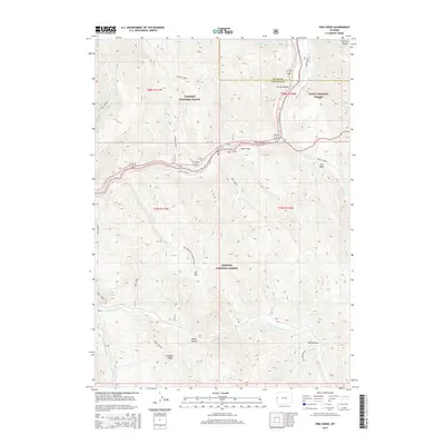
2015 Map of Pine Creek
USGS Topo · Published 2015About this map
Pine Bar sits at the confluence of several high-mountain watercourses where the Wyoming Range meets the deep drainage of the Grand Canyon. This area is defined by a dense network of mountain streams including Skull Creek, Station Creek, and Bailey Creek, which flow through a landscape managed across three federal jurisdictions: the Targhee National Forest, Teton National Forest, and Bridger National Forest. The map captures the complex topography of the Elk Mountain Lookout Spur and the prominent Elk Mtn, which dominates the central terrain. Evidence of the region's hydrological importance is clear in the south, where the Little Greys River and Greys River converge near Bull Hollow. This 2015 survey provides a modern view of this remote intersection of Teton and Lincoln counties, documenting established access routes like River Bend Rd and named geographic features such as Aspen Hollow.
Find a feature on this map
46 named features on this map. Tap any name to fly to it.
Don’t see what you’re looking for? This feature index may not catch every label — zoom into the map to look around manually.
Map Details
Editions of this 2015 Pine Creek Map
This is the sole edition of this map. No revisions or reprints were ever made.
Other maps of this area

1931 · Jackson
USGS Topo · 1:125,000

1935 · Jackson
USGS Topo · 1:125,000

1955 · Driggs
USGS Topo · 1:250,000

1958 · Driggs
USGS Topo · 1:250,000

1962 · Driggs
USGS Topo · 1:250,000

1963 · Munger Mountain
USGS Topo · 1:24,000

1963 · Observation Peak
USGS Topo · 1:24,000

1963 · Ferry Peak
USGS Topo · 1:24,000

1965 · Pickle Pass
USGS Topo · 1:24,000

1965 · Camp Davis
USGS Topo · 1:24,000