
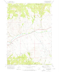
2011 Map of Pine Creek Mountain
USGS Topo · Published 2011About this map
Pine Creek Mountain anchors this rugged section of Grant County, where the high ridges of the Blue Mountains are defined by a history of resource extraction and ranching. The landscape is marked by numerous legacy mining operations, including the Marks-Thompson Mine in the northeast and the Celebration Mine located near the Pine Creek Trailhead. The drainage network is particularly dense here, with Pine Creek, Little Indian Creek, and Miners Creek carving deep canyons through the terrain. Evidence of high-country land use is visible through several established campsites and corrals, such as Yokum Corrals Camp and the uniquely named Hotel de Bum Camp. The northern reaches of the map show established agricultural footprints at Miller Ranch and Howard Ranch, while the interior remains dominated by prominent summits like Elk Mountain, Spud Mountain, and the massive Wall Creek Ridge.
Find a feature on this map
54 named features on this map. Tap any name to fly to it.
Don’t see what you’re looking for? This feature index may not catch every label — zoom into the map to look around manually.
Map Details
Editions of this 2011 Pine Creek Mountain Map
This is the sole edition of this map. No revisions or reprints were ever made.
Other maps of this area

1940 · John Day
USGS Topo · 1:62,500

1943 · John Day
USGS Topo · 1:62,500

1955 · Canyon City
USGS Topo · 1:250,000

1959 · Canyon City
USGS Topo · 1:250,000

1959 · Prairie City
USGS Topo · 1:62,500

1961 · Logan Valley
USGS Topo · 1:62,500

1961 · Seneca
USGS Topo · 1:62,500

1972 · John Day
USGS Topo · 1:24,000

1972 · Canyon Mtn
USGS Topo · 1:24,000
1972 · Castle Creek
USGS Topo · 1:24,000