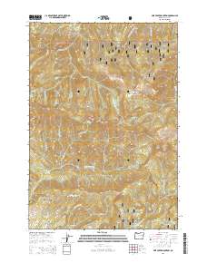
2014 Map of Pine Creek Mountain
USGS Topo · Published 2014About this map
Malhuer National Forest terrain dominates this high-elevation portion of Grant County, where the Blue Mountains rise toward the summit of Pine Creek Mountain. The landscape is defined by its complex drainage network, where waters from Halls Lake feed into a maze of alpine creeks including W Fork Pine Cr and Brookling Cr. This 2014 survey documents the remote character of the region, emphasizing landmark ridges and geologic features that have long guided travelers through these woods. Prominent high points such as Indian Creek Butte, Yellow Jacket Ridge, and Bear Skull Rims provide a structural framework for the numerous named springs and gulches that characterize the forest. The presence of features like Gand Saddle and Buckhorn Meadow indicates traditional grazing or transit areas within the mountain range, while the convergence of Miners Cr and Middle Fork Canyon Cr illustrates the erosional forces that have shaped this portion of the Pacific Northwest.
Find a feature on this map
46 named features on this map. Tap any name to fly to it.
Don’t see what you’re looking for? This feature index may not catch every label — zoom into the map to look around manually.
Map Details
Editions of this 2014 Pine Creek Mountain Map
This is the sole edition of this map. No revisions or reprints were ever made.
Other maps of this area

1940 · John Day
USGS Topo · 1:62,500

1943 · John Day
USGS Topo · 1:62,500

1955 · Canyon City
USGS Topo · 1:250,000

1959 · Canyon City
USGS Topo · 1:250,000

1959 · Prairie City
USGS Topo · 1:62,500

1961 · Logan Valley
USGS Topo · 1:62,500

1961 · Seneca
USGS Topo · 1:62,500

1972 · John Day
USGS Topo · 1:24,000

1972 · Canyon Mtn
USGS Topo · 1:24,000
1972 · Castle Creek
USGS Topo · 1:24,000