
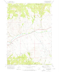
2020 Map of Pine Creek Mountain
USGS Topo · Published 2020About this map
The high ridges and deep drainages of the Malheur National Forest define this 2020 map of Grant County. Central to the area is the prominent peak of Pine Creek Mtn, which anchors a landscape of steep timbered slopes and seasonal water sources. Hydrological patterns are dominated by the intricate network of the Pine Cr watershed, alongside numerous springs such as Twin Springs and Anchor Spring that served as vital water points for early land management and grazing.
Find a feature on this map
47 named features on this map. Tap any name to fly to it.
Don’t see what you’re looking for? This feature index may not catch every label — zoom into the map to look around manually.
Map Details
Editions of this 2020 Pine Creek Mountain Map
This is the sole edition of this map. No revisions or reprints were ever made.
Other maps of this area

1940 · John Day
USGS Topo · 1:62,500

1943 · John Day
USGS Topo · 1:62,500

1955 · Canyon City
USGS Topo · 1:250,000

1959 · Canyon City
USGS Topo · 1:250,000

1959 · Prairie City
USGS Topo · 1:62,500

1961 · Logan Valley
USGS Topo · 1:62,500

1961 · Seneca
USGS Topo · 1:62,500

1972 · John Day
USGS Topo · 1:24,000

1972 · Canyon Mtn
USGS Topo · 1:24,000
1972 · Castle Creek
USGS Topo · 1:24,000