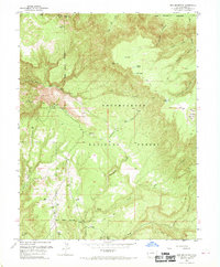
1960 Map of Pine Mountain
USGS Topo · Published 1969About this map
The Uncompahgre National Forest dominates this high-altitude landscape, where deep drainages like Yellowjacket Canyon and Maverick Canyon carve through the plateau. This 1960 revision, based on 1947 aerial photography, reveals a remote wilderness defined by water sources and ridge-top navigation. Isolated water bodies such as Far Pond, Middle Pond, and Rim Pond are scattered across the higher elevations, likely serving as critical points for cattle or wildlife in the arid terrain.
Find a feature on this map
25 named features on this map. Tap any name to fly to it.
Don’t see what you’re looking for? This feature index may not catch every label — zoom into the map to look around manually.
Map Details
Editions of this 1960 Pine Mountain Map
3 editions found
Other maps of this area

1949 · Juanita Arch
USGS Topo · 1:24,000

1949 · Calamity Mesa
USGS Topo · 1:24,000

1949 · Gateway
USGS Topo · 1:24,000

1950 · Juanita Arch
USGS Topo · 1:24,000

1950 · Calamity Mesa
USGS Topo · 1:24,000

1950 · Pine Mountain
USGS Topo · 1:24,000

1952 · Gateway
USGS Topo · 1:24,000

1956 · Moab
USGS Topo · 1:250,000

1959 · Moab
USGS Topo · 1:250,000

1960 · Moab
USGS Topo · 1:250,000