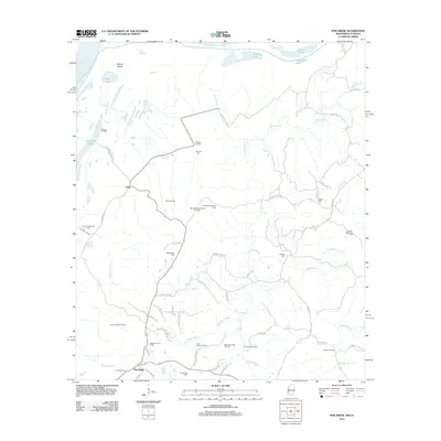
2012 Map of Pine Ridge
USGS Topo · Published 2012About this map
Mercer Island and the sprawling Mississippi River corridor define the western edge of this landscape, where the alluvial bottomlands meet the rising bluffs of Adams County. The interior is a complex network of bayous and creeks, including Quitman Bayou and Fairchilds Cr, which weave through a terrain dominated by energy extraction. Numerous active petroleum sites, such as the Anna Oil Field, Oakland Oil Field, and Stanton Oil Field, are interspersed with historic rural settlements. The small communities of Anna and Pine Ridge serve as focal points for a web of local roads named for early residents and landmarks, including Emerald Mound Rd and Morning Glory Rd. Family history is preserved in scattered plots like Painters Cem and the Drake-Magruder Cem, illustrating the long-standing connection between the land's agricultural roots and its modern industrial role.
Find a feature on this map
74 named features on this map. Tap any name to fly to it.
Don’t see what you’re looking for? This feature index may not catch every label — zoom into the map to look around manually.
Map Details
Editions of this 2012 Pine Ridge Map
This is the sole edition of this map. No revisions or reprints were ever made.
Other maps of this area

1909 · Vidalia
USGS Topo · 1:24,000

1921 · Natchez
USGS Topo · 1:48,000

1922 · Natchez
USGS Topo · 1:62,500

1939 · Lorman
USGS Topo · 1:62,500

1939 · Natchez
USGS Topo · 1:62,500

1939 · Locust Ridge
USGS Topo · 1:62,500

1953 · Natchez
USGS Topo · 1:250,000

1956 · Natchez
USGS Topo · 1:250,000

1958 · St. Joseph
USGS Topo · 1:62,500

1959 · Natchez
USGS Topo · 1:250,000