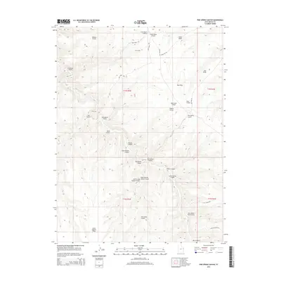
2014 Map of Pine Spring Canyon
USGS Topo · Published 2014About this map
Mayos Cabin stands as a lone human marker in this high-altitude landscape of Uintah County, defined by a series of parallel ridges and deep drainage systems. The terrain is structured by prominent landforms like Seep Ridge and Indian Ridge, which separate a complex network of canyons. The naming conventions here, such as Big Asphalt Canyon, Little Asphalt Canyon, and Little Asphalt Ridge, point toward the region's geological history and the presence of natural hydrocarbon deposits that have long defined the local economy.
Find a feature on this map
33 named features on this map. Tap any name to fly to it.
Don’t see what you’re looking for? This feature index may not catch every label — zoom into the map to look around manually.
Map Details
Editions of this 2014 Pine Spring Canyon Map
This is the sole edition of this map. No revisions or reprints were ever made.
Other maps of this area

1885 · East Tavaputs
USGS Topo · 1:250,000

1956 · Grand Junction
USGS Topo · 1:250,000

1959 · Grand Junction
USGS Topo · 1:250,000

1960 · Grand Junction
USGS Topo · 1:250,000

1962 · Grand Junction
USGS Topo · 1:250,000

1963 · Tenmile Canyon
USGS Topo · 1:62,500

1964 · Grand Junction
USGS Topo · 1:250,000

1965 · Grand Junction
USGS Topo · 1:250,000

1966 · Seep Canyon
USGS Topo · 1:24,000

1966 · Bates Knolls
USGS Topo · 1:24,000