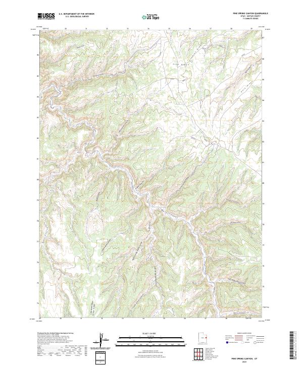
2023 Map of Pine Spring Canyon
USGS Topo · Published 2023About this map
Pine Spring serves as a critical water point in this drainage-heavy landscape of Uintah County, where high plateaus are deeply incised by a complex system of canyons. The map reveals a transition from the elevated Seep Ridge and Indian Ridge in the north down into the expansive Main Canyon system. This area is defined by its industrial and transit history, evidenced by the presence of Big Asphalt Canyon and the winding Jacks Wagon Road Canyon, suggesting early extraction efforts and established freighting routes through the Book Cliffs region.
Find a feature on this map
25 named features on this map. Tap any name to fly to it.
Don’t see what you’re looking for? This feature index may not catch every label — zoom into the map to look around manually.
Map Details
Editions of this 2023 Pine Spring Canyon Map
This is the sole edition of this map. No revisions or reprints were ever made.
Other maps of this area

1885 · East Tavaputs
USGS Topo · 1:250,000

1956 · Grand Junction
USGS Topo · 1:250,000

1959 · Grand Junction
USGS Topo · 1:250,000

1960 · Grand Junction
USGS Topo · 1:250,000

1962 · Grand Junction
USGS Topo · 1:250,000

1963 · Tenmile Canyon
USGS Topo · 1:62,500

1964 · Grand Junction
USGS Topo · 1:250,000

1965 · Grand Junction
USGS Topo · 1:250,000

1966 · Seep Canyon
USGS Topo · 1:24,000

1966 · Bates Knolls
USGS Topo · 1:24,000