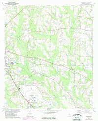
1974 Map of Pineboro
USGS Topo · Published 1988About this map
Spence Field occupies the southern reach of this landscape, its structured runways and facility layout contrasting with the surrounding agricultural and creek-cut terrain. This survey reflects the rural-industrial character of Colquitt County in the mid-1970s and 1980s, particularly near the edge of Moultrie. Evidence of industry is clear in the Industrial Waste Ponds located west of Indian Creek. Historically significant transport lines are visible through the Old Railroad Grade, which passes near Barbers in the northwest. Local life centers around a network of country churches and community centers like Pineboro, Norman Grove Ch, and Mt Olive Ch. The drainage patterns are defined by the Middle Prong Indian Creek and Reedy Creek, which supported local education at the Reedy Creek Sch.
Find a feature on this map
30 named features on this map. Tap any name to fly to it.
Don’t see what you’re looking for? This feature index may not catch every label — zoom into the map to look around manually.
Map Details
Editions of this 1974 Pineboro Map
2 editions found
Other maps of this area

1953 · Waycross
USGS Topo · 1:250,000

1956 · Doerun
USGS Topo · 1:62,500

1958 · Waycross
USGS Topo · 1:250,000

1973 · Norman Park
USGS Topo · 1:24,000

1973 · Omega
USGS Topo · 1:24,000

1974 · Berlin East
USGS Topo · 1:24,000
1974 · Sigsbee
USGS Topo · 1:24,000

1974 · Pineboro
USGS Topo · 1:24,000
1974 · Ellenton
USGS Topo · 1:24,000
1978 · Coolidge
USGS Topo · 1:24,000