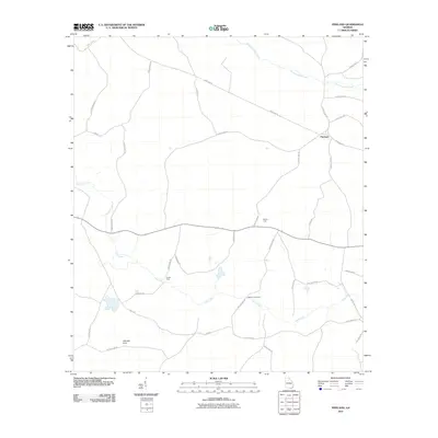
2011 Map of Pineland
USGS Topo · Published 2011About this map
Pineland serves as a central hub in this landscape of southern Georgia, where a network of county roads and local lanes like Pineland Rd and New Shanty Rd connect dispersed settlements and crossing points. The topography is defined by the winding paths of Suwannoochee Creek in the northeast and Toms Creek flowing through the southern half of the quadrangle. Significant water-related features and fords, such as Brown Ford and Martha Johns Ford, suggest the importance of specific creek crossings for local travel and commerce.
Find a feature on this map
35 named features on this map. Tap any name to fly to it.
Don’t see what you’re looking for? This feature index may not catch every label — zoom into the map to look around manually.
Map Details
Editions of this 2011 Pineland Map
This is the sole edition of this map. No revisions or reprints were ever made.
Other maps of this area

1954 · Valdosta
USGS Topo · 1:250,000

1955 · Jasper
USGS Topo · 1:24,000

1955 · Cypress Creek
USGS Topo · 1:24,000

1955 · Fargo SW
USGS Topo · 1:24,000

1958 · Valdosta
USGS Topo · 1:250,000

1959 · Valdosta
USGS Topo · 1:250,000

1968 · Needmore
USGS Topo · 1:24,000

1968 · Headlight
USGS Topo · 1:24,000

1971 · Thelma
USGS Topo · 1:24,000

1971 · Tarver
USGS Topo · 1:24,000