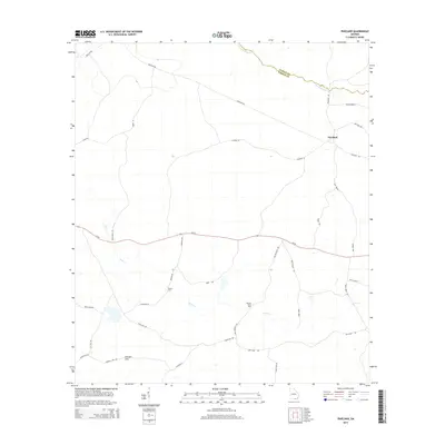
2014 Map of Pineland
USGS Topo · Published 2014About this map
The low-lying pine woods of South Georgia define this area on the border of Clinch and Echols counties. The small settlement of Pineland serves as a central point in a landscape crisscrossed by rural timber and access routes like Register Rd and Cow Trail Rd. Significant water features, including Suwannoochee Cr and the winding Toms Cr, dictate the placement of historical river crossings such as Brown Ford and Martha Johns Ford. These named fords are vital indicators of the local transport network before modern bridge infrastructure was fully established.
Find a feature on this map
32 named features on this map. Tap any name to fly to it.
Don’t see what you’re looking for? This feature index may not catch every label — zoom into the map to look around manually.
Map Details
Editions of this 2014 Pineland Map
This is the sole edition of this map. No revisions or reprints were ever made.
Other maps of this area

1954 · Valdosta
USGS Topo · 1:250,000

1955 · Jasper
USGS Topo · 1:24,000

1955 · Cypress Creek
USGS Topo · 1:24,000

1955 · Fargo SW
USGS Topo · 1:24,000

1958 · Valdosta
USGS Topo · 1:250,000

1959 · Valdosta
USGS Topo · 1:250,000

1968 · Needmore
USGS Topo · 1:24,000

1968 · Headlight
USGS Topo · 1:24,000

1971 · Thelma
USGS Topo · 1:24,000

1971 · Tarver
USGS Topo · 1:24,000