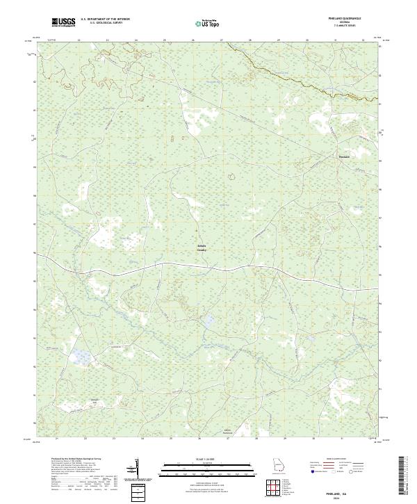
2024 Map of Pineland
USGS Topo · Published 2024About this map
Suwannochee Creek and its many interconnected wetland basins dominate this pocket of the coastal plain in Echols County, Georgia. This modern-era survey illustrates a landscape of dense bays and hammocks, such as Savannah Bay, Tiger Bay, and the southern Martin Hammock. These features are woven together by a network of rural routes and specialized roads including Pineland Haylow Rd and Gopher Lope Rd, reflecting the area's ongoing connection to forestry and land management.
Find a feature on this map
47 named features on this map. Tap any name to fly to it.
Don’t see what you’re looking for? This feature index may not catch every label — zoom into the map to look around manually.
Map Details
Editions of this 2024 Pineland Map
This is the sole edition of this map. No revisions or reprints were ever made.
Other maps of this area

1954 · Valdosta
USGS Topo · 1:250,000

1955 · Jasper
USGS Topo · 1:24,000

1955 · Cypress Creek
USGS Topo · 1:24,000

1955 · Fargo SW
USGS Topo · 1:24,000

1958 · Valdosta
USGS Topo · 1:250,000

1959 · Valdosta
USGS Topo · 1:250,000

1968 · Needmore
USGS Topo · 1:24,000

1968 · Headlight
USGS Topo · 1:24,000

1971 · Thelma
USGS Topo · 1:24,000

1971 · Tarver
USGS Topo · 1:24,000