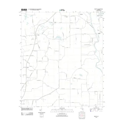
2012 Map of Pinetta
USGS Topo · Published 2012About this map
The Withlacoochee River carves the eastern boundary of this landscape, anchoring a rural corridor defined by small hamlets and agricultural tracts. Pinetta and Bellville serve as central nodes for the region, while the northern reaches are dotted with private aviation sites like Bass Limited Airport and Estherbrook Aerodrome. Genealogists will find particular value in the proximity of Herndon Cem and Bell Cem near the riverbanks. The mapping of Hanson and Leland illustrates the persisting network of local roads such as Co HWY-150, which connect these dispersed settlements. To the south, the Gibson Lookout Tower stands as a landmark amidst a mosaic of water bodies including Grassy Pond and Langford Pond, reflecting a landscape deeply integrated with its hydrology and timber resources.
Find a feature on this map
97 named features on this map. Tap any name to fly to it.
Don’t see what you’re looking for? This feature index may not catch every label — zoom into the map to look around manually.
Map Details
Editions of this 2012 Pinetta Map
This is the sole edition of this map. No revisions or reprints were ever made.
Other maps of this area

1954 · Valdosta
USGS Topo · 1:250,000

1956 · Clyattville
USGS Topo · 1:24,000

1956 · Nankin
USGS Topo · 1:24,000

1956 · Octahatchee
USGS Topo · 1:24,000

1958 · Valdosta
USGS Topo · 1:250,000

1958 · Lee
USGS Topo · 1:24,000

1959 · Valdosta
USGS Topo · 1:250,000

1959 · Madison
USGS Topo · 1:24,000

1959 · Ellaville
USGS Topo · 1:24,000

1960 · Cherry Lake
USGS Topo · 1:24,000