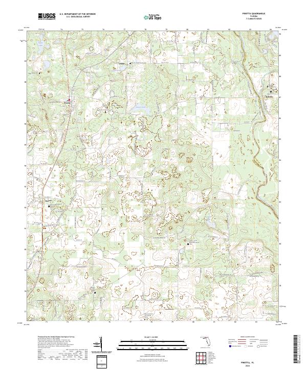
2024 Map of Pinetta
USGS Topo · Published 2024About this map
Pinetta and the surrounding rural landscape of northern Madison County are defined by a network of family-named roads and community landmarks near the Georgia border. The Withlacoochee River forms the eastern boundary, winding past the settlement of Bellville and the Bellville Baptist Cemetery. This modern survey reveals a deep-rooted social geography, where local identity is anchored by numerous small congregations and burying grounds, including the Allen Family Cemetery and the Oak Grove Cemetery.
Find a feature on this map
124 named features on this map. Tap any name to fly to it.
Don’t see what you’re looking for? This feature index may not catch every label — zoom into the map to look around manually.
Map Details
Editions of this 2024 Pinetta Map
This is the sole edition of this map. No revisions or reprints were ever made.
Other maps of this area

1954 · Valdosta
USGS Topo · 1:250,000

1956 · Clyattville
USGS Topo · 1:24,000

1956 · Nankin
USGS Topo · 1:24,000

1956 · Octahatchee
USGS Topo · 1:24,000

1958 · Valdosta
USGS Topo · 1:250,000

1958 · Lee
USGS Topo · 1:24,000

1959 · Valdosta
USGS Topo · 1:250,000

1959 · Madison
USGS Topo · 1:24,000

1959 · Ellaville
USGS Topo · 1:24,000

1960 · Cherry Lake
USGS Topo · 1:24,000