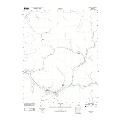
2010 Map of Pineville
USGS Topo · Published 2010About this map
The Cumberland River carves a deep path through the coal-rich mountains of Bell County, centering on the community of Pineville. This 2010 survey shows the tight coordination of infrastructure and settlement within the narrow valleys, where the river meets the Wallsend and Dorton Branch communities. The landscape is defined by its verticality, featuring landmarks like Chain Rock and Toms Cliffs, while the higher ridges are marked by the Bird Branch Lookout Tower. The industrial legacy of the region is evident in the string of small settlements along the tributaries, including Cary, Arjay, and Blanche along Caney Creek. For genealogists and local historians, several family and community burial grounds are mapped, such as Henderson Cemetery, Red Hill Cemetery, and Liberty Cemetery, providing essential spatial context for the region's ancestral roots and the settlement patterns that followed the winding river and creek beds.
Find a feature on this map
75 named features on this map. Tap any name to fly to it.
Don’t see what you’re looking for? This feature index may not catch every label — zoom into the map to look around manually.
Map Details
Editions of this 2010 Pineville Map
This is the sole edition of this map. No revisions or reprints were ever made.
Other maps of this area

1886 · Cumberland Gap
USGS Topo · 1:125,000

1888 · Cumberland Gap
USGS Topo · 1:125,000

1891 · Cumberland Gap
USGS Topo · 1:125,000

1903 · Pineville
USGS Topo · 1:48,000

1903 · Middlesboro
USGS Topo · 1:48,000

1927 · Middlesboro
USGS Topo · 1:62,500

1930 · Middlesboro
USGS Topo · 1:62,500

1935 · Varilla
USGS Topo · 1:24,000

1952 · Fount
USGS Topo · 1:24,000
1952 · Artemus
USGS Topo · 1:24,000