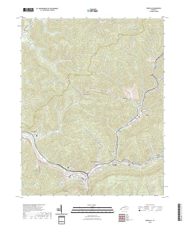
2022 Map of Pineville
USGS Topo · Published 2022About this map
The Cumberland River bends sharply around Pineville, the central hub of this contemporary survey of the Bell Co and Knox Co borderlands. The landscape is defined by the massive ridge of Pine Mountain, where landmarks like Chain Rock and the Chained Rock Trl overlook the valley floor. Settlement is concentrated along the narrow valley corridors, with established neighborhoods in Wallsend and Straight Creek following the water's edge.
Find a feature on this map
101 named features on this map. Tap any name to fly to it.
Don’t see what you’re looking for? This feature index may not catch every label — zoom into the map to look around manually.
Map Details
Editions of this 2022 Pineville Map
This is the sole edition of this map. No revisions or reprints were ever made.
Other maps of this area

1886 · Cumberland Gap
USGS Topo · 1:125,000

1888 · Cumberland Gap
USGS Topo · 1:125,000

1891 · Cumberland Gap
USGS Topo · 1:125,000

1903 · Pineville
USGS Topo · 1:48,000

1903 · Middlesboro
USGS Topo · 1:48,000

1927 · Middlesboro
USGS Topo · 1:62,500

1930 · Middlesboro
USGS Topo · 1:62,500

1935 · Varilla
USGS Topo · 1:24,000

1952 · Fount
USGS Topo · 1:24,000
1952 · Artemus
USGS Topo · 1:24,000