
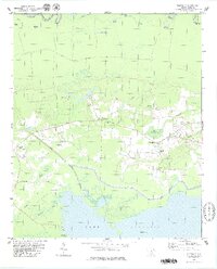
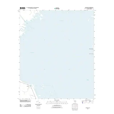
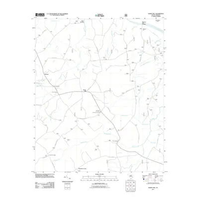
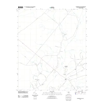
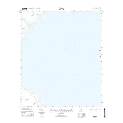
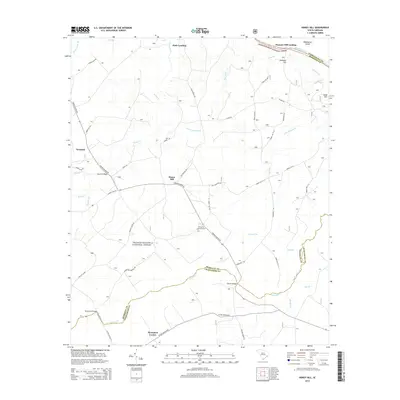
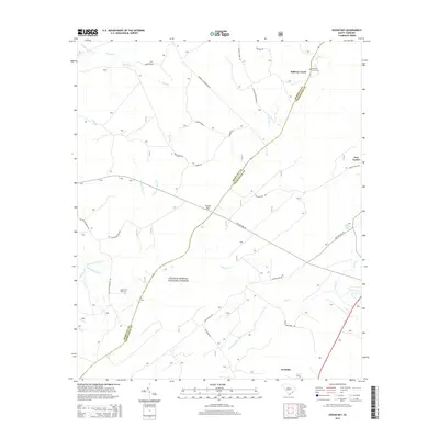
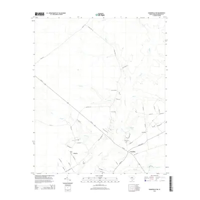
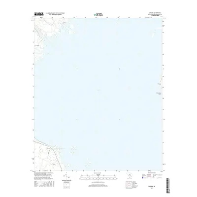
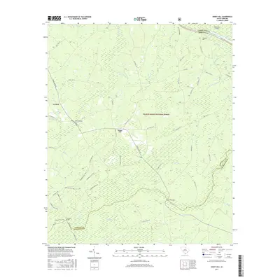
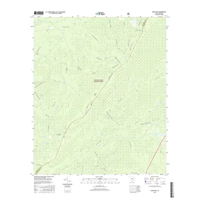
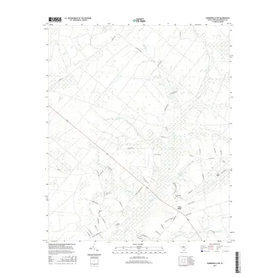
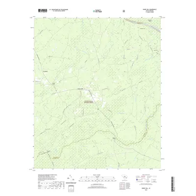
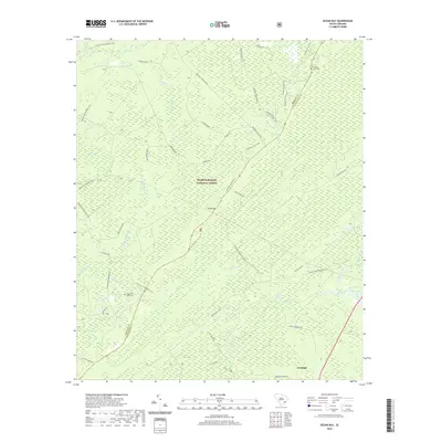
1979 Map of Pineville
USGS Topo · Published 1992About this map
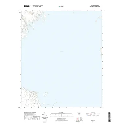
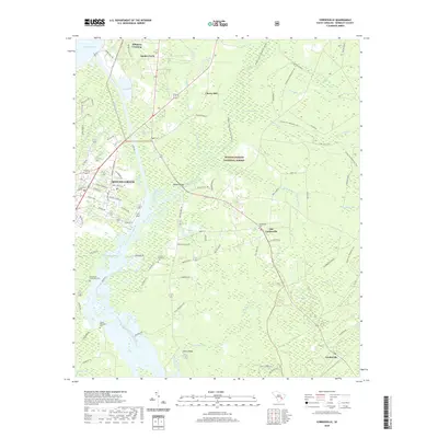
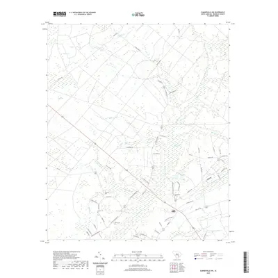
The Site of Francis Marion Tomb Cem anchors this landscape in Berkeley County, marking the burial place of the Revolutionary War's "Swamp Fox." The terrain is defined by the heavy presence of the Santee River to the north and the expansive Lake Moultrie to the south, with the Santee Canal (Abandoned) serving as a historical relic of early American civil engineering cutting through the center. Around the crossroads of Pineville, numerous local institutions such as Redeemer Ch, Messiah Ch, and the Pineville Airport indicate a persistent rural community. The map is particularly valuable for genealogical research, showing many family and community burial sites including Richmond Cem, Mexico Cem, and Lifeland Cem. Between the lakes and the river, the ground is saturated with cypress-choked features like Maham Swamp and Margate Swamp, reflecting the classic Lowcountry geography.
Find a feature on this map
45 named features on this map. Tap any name to fly to it.
Don’t see what you’re looking for? This feature index may not catch every label — zoom into the map to look around manually.
Map Details
Editions of this 1979 Pineville Map
2 editions found
Historical Maps of Judge Town Through Time
105 maps found

1919 Cordesville
Berkeley County, SC

1919 Melgrove
Berkeley County, SC

1919 Wando
Berkeley County, SC

1920 Chicora
Berkeley County, SC

1921 Chicora
Berkeley County, SC

1940 Melgrove
Berkeley County, SC

1942 Honey Hill
Berkeley County, SC

1943 Chicora
Berkeley County, SC

1943 Ocean Bay
Berkeley County, SC

1943 Shulerville
Berkeley County, SC

1943 Wando
Berkeley County, SC

1948 Bethera
Berkeley County, SC

1948 Cordesville
Berkeley County, SC

1949 Cordesville
Berkeley County, SC

1950 Bethera
Berkeley County, SC

1950 Huger
Berkeley County, SC

1950 Kittredge
Berkeley County, SC

1957 Mount Holly
Berkeley County, SC

1958 Cainhoy
Berkeley County, SC

1958 Summerville NW
Berkeley County, SC

1979 Chicora
Berkeley County, SC

1979 Cross
Berkeley County, SC

1979 Eadytown
Berkeley County, SC
1979 Pineville
Berkeley County, SC

1990 Alvin
Berkeley County, SC
2011 Alvin
Berkeley County, SC
2011 Bethera
Berkeley County, SC
2011 Cainhoy
Berkeley County, SC
2011 Chicora
Berkeley County, SC
2011 Cordesville
Berkeley County, SC
2011 Cross
Berkeley County, SC
2011 Eadytown
Berkeley County, SC
2011 Honey Hill
Berkeley County, SC
2011 Huger
Berkeley County, SC
2011 Kittredge
Berkeley County, SC
2011 Mount Holly
Berkeley County, SC
2011 Ocean Bay
Berkeley County, SC
2011 Pineville
Berkeley County, SC
2011 Saint Stephen
Berkeley County, SC
2011 Shulerville
Berkeley County, SC
2011 Summerville NW
Berkeley County, SC
2014 Alvin
Berkeley County, SC
2014 Bethera
Berkeley County, SC
2014 Cainhoy
Berkeley County, SC
2014 Chicora
Berkeley County, SC
2014 Cordesville
Berkeley County, SC
2014 Cross
Berkeley County, SC
2014 Eadytown
Berkeley County, SC
2014 Honey Hill
Berkeley County, SC
2014 Huger
Berkeley County, SC
2014 Kittredge
Berkeley County, SC
2014 Mount Holly
Berkeley County, SC
2014 Ocean Bay
Berkeley County, SC
2014 Pineville
Berkeley County, SC
2014 Saint Stephen
Berkeley County, SC
2014 Shulerville
Berkeley County, SC
2014 Summerville NW
Berkeley County, SC
2017 Alvin
Berkeley County, SC
2017 Bethera
Berkeley County, SC
2017 Cainhoy
Berkeley County, SC
2017 Chicora
Berkeley County, SC
2017 Cordesville
Berkeley County, SC
2017 Cross
Berkeley County, SC
2017 Eadytown
Berkeley County, SC
2017 Honey Hill
Berkeley County, SC
2017 Huger
Berkeley County, SC
2017 Kittredge
Berkeley County, SC
2017 Mount Holly
Berkeley County, SC
2017 Ocean Bay
Berkeley County, SC
2017 Pineville
Berkeley County, SC
2017 Saint Stephen
Berkeley County, SC
2017 Shulerville
Berkeley County, SC
2017 Summerville NW
Berkeley County, SC
2020 Alvin
Berkeley County, SC
2020 Bethera
Berkeley County, SC
2020 Cainhoy
Berkeley County, SC
2020 Chicora
Berkeley County, SC
2020 Cordesville
Berkeley County, SC
2020 Cross
Berkeley County, SC
2020 Eadytown
Berkeley County, SC
2020 Honey Hill
Berkeley County, SC
2020 Huger
Berkeley County, SC
2020 Kittredge
Berkeley County, SC
2020 Mount Holly
Berkeley County, SC
2020 Ocean Bay
Berkeley County, SC
2020 Pineville
Berkeley County, SC
2020 Saint Stephen
Berkeley County, SC
2020 Shulerville
Berkeley County, SC
2020 Summerville NW
Berkeley County, SC

2024 Alvin
Berkeley County, SC

2024 Bethera
Berkeley County, SC

2024 Cainhoy
Berkeley County, SC

2024 Chicora
Berkeley County, SC

2024 Cordesville
Berkeley County, SC

2024 Cross
Berkeley County, SC

2024 Eadytown
Berkeley County, SC

2024 Honey Hill
Berkeley County, SC

2024 Huger
Berkeley County, SC

2024 Kittredge
Berkeley County, SC

2024 Mount Holly
Berkeley County, SC

2024 Ocean Bay
Berkeley County, SC

2024 Pineville
Berkeley County, SC

2024 Saint Stephen
Berkeley County, SC

2024 Shulerville
Berkeley County, SC

2024 Summerville NW
Berkeley County, SC