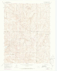
1966 Map of Piney Creek
USGS Topo · Published 1973About this map
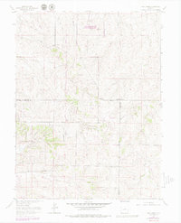
Military Reservation lands and evolving rural boundaries dominate this survey of the high plains southeast of Denver. The landscape is defined by the headwaters of the South Platte drainage, including the branching paths of West Toll Gate Creek and East Toll Gate Creek, alongside the namesake Piney Creek. This mid-1960s edition, with purple photorevisions from 1971, captures the transition from traditional ranching to suburban expansion, noted by the presence of a Cem and Gravel Pit. Important transit corridors like the historic Smoky Hill Road and Airline Road cut across the drainage basins of Sampson Gulch and Baldwin Gulch, marking the routes of early commerce. Strategic infrastructure is visible through an Observation Tower, a Radio Facility, and a private Landing Strip, reflecting the integration of utility and aviation into the once-quiet drainages of Murphy Creek and Coal Creek.
Find a feature on this map
22 named features on this map. Tap any name to fly to it.
Don’t see what you’re looking for? This feature index may not catch every label — zoom into the map to look around manually.
Map Details
Editions of this 1966 Piney Creek Map
6 editions found
Other maps of this area

1890 · East Denver
USGS Topo · 1:125,000

1894 · Castle Rock
USGS Topo · 1:125,000

1913 · Castle Rock
USGS Topo · 1:125,000

1935 · East Denver Nos. 3 and 4
USGS Topo · 1:48,000

1939 · Coal Creek
USGS Topo · 1:24,000

1939 · Elizabeth
USGS Topo · 1:62,500

1940 · Piney Creek
USGS Topo · 1:24,000

1940 · Castle Rock
USGS Topo · 1:62,500

1941 · Fitzsimons
USGS Topo · 1:31,680

1942 · Parker
USGS Topo · 1:31,680