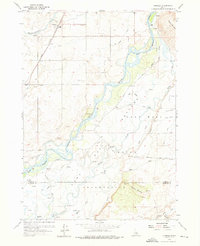
1955 Map of Pingree
USGS Topo · Published 1976About this map
The Fort Hall Indian Reservation dominates the landscape of this mid-century survey, where the Snake River carves a winding path through Bingham and Bannock counties. The agricultural settlement of Pingree serves as a northern anchor, connected to the wider region by the Union Pacific railroad and the Aberdeen Springfield Road. A notable layer of Western migration history is preserved here through the charted Oregon Trail, which follows the southern banks of the river across the reservation lands. The terrain is marked by prominent volcanic features such as Ferry Butte and Cedar Butte, which rise above the intricate network of watercourses including Mud Slough, Dignie Creek, and Spring Creek. Evidence of local infrastructure and community life appears in the form of a small Cem and Gravel Pits, alongside named routes like Shoemaker Road and Bronco Road.
Find a feature on this map
38 named features on this map. Tap any name to fly to it.
Don’t see what you’re looking for? This feature index may not catch every label — zoom into the map to look around manually.
Map Details
Editions of this 1955 Pingree Map
4 editions found
Other maps of this area

1934 · Michaud
USGS Topo · 1:62,500

1937 · Pocatello
USGS Topo · 1:48,000

1937 · Michaud
USGS Topo · 1:62,500

1940 · Blackfoot
USGS Topo · 1:62,500

1943 · Blackfoot
USGS Topo · 1:62,500

1944 · Pocatello
USGS Topo · 1:62,500

1954 · Pocatello
USGS Topo · 1:250,000

1955 · Springfield NW
USGS Topo · 1:24,000

1955 · Rockford
USGS Topo · 1:24,000

1955 · Pingree
USGS Topo · 1:24,000