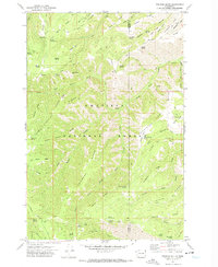
1971 Map of Pinkham Butte
USGS Topo · Published 1974About this map
Umatilla National Forest encompasses the majority of this 1971 terrain, defined by a complex network of high ridges and deeply cut canyons. The landscape is marked by a series of named spurs and promontories like Devils Tailbone and Jump Off Joe Point, separated by the drainage basins of Asotin Creek and Menatchee Creek. This survey reveals a wilderness managed through a specialized network of trails, including the evocative Hard-To-Get-To Trail and the Asotin Pack Trail, rather than a traditional road system. The concentration of water sources, from Wickiuo Spring to Pinkham Spring, highlights the critical infrastructure required for both forest management and historical livestock grazing on the high flats like Smoothing Prairie. Collectors and historians can trace the precise boundary between Garfield Co and Asotin Co as it follows the topographical divides near Pinkham Butte.
Find a feature on this map
57 named features on this map. Tap any name to fly to it.
Don’t see what you’re looking for? This feature index may not catch every label — zoom into the map to look around manually.
Map Details
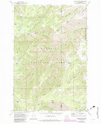
Editions of this 1971 Pinkham Butte Map
2 editions found
Other maps of this area

1937 · Pomeroy
USGS Topo · 1:96,000

1942 · Pomeroy
USGS Topo · 1:125,000

1943 · Peola
USGS Topo · 1:62,500

1943 · Saddle Butte
USGS Topo · 1:62,500

1946 · Saddle Butte
USGS Topo · 1:62,500

1946 · Peola
USGS Topo · 1:62,500

1955 · Pullman
USGS Topo · 1:250,000

1958 · Pullman
USGS Topo · 1:250,000

1967 · Rose Springs
USGS Topo · 1:24,000

1967 · Stentz Spring
USGS Topo · 1:24,000