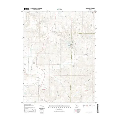
2015 Map of Pinnacle Lake
USGS Topo · Published 2015About this map
Pinnacle Lake and the surrounding woodlands of eastern Missouri define this landscape, where the Loutre River and its numerous tributaries like Whippoorwill Cr and Bear Cr carve through the terrain. The map captures a primarily rural environment near High Hill, punctuated by localized landmarks like The Pinnacle and Mary White Hollow. Genealogists will find a high density of family and community burial sites, including Snethen Cemetery, Patton Cemetery, and Uthlaut Cemetery, which are scattered among the ridges and valleys. The settlement of Big Spring serves as a small local hub in the western portion, while the boundary between Montgomery Co and Warren Co runs through the eastern hills, marking the intersection of these two administrative districts amidst a network of country lanes like Loutre Bend Rd and Tower Rd.
Find a feature on this map
89 named features on this map. Tap any name to fly to it.
Don’t see what you’re looking for? This feature index may not catch every label — zoom into the map to look around manually.
Map Details
Editions of this 2015 Pinnacle Lake Map
This is the sole edition of this map. No revisions or reprints were ever made.
Other maps of this area

1890 · Hermann
USGS Topo · 1:125,000

1890 · Fulton
USGS Topo · 1:125,000

1935 · Morrison
USGS Topo · 1:48,000

1936 · Hermann
USGS Topo · 1:48,000

1940 · Montgomery City
USGS Topo · 1:62,500

1942 · Montgomery City
USGS Topo · 1:62,500

1942 · Morrison
USGS Topo · 1:62,500

1942 · Hermann
USGS Topo · 1:62,500

1942 · New Florence
USGS Topo · 1:62,500

1945 · Hermann
USGS Topo · 1:62,500