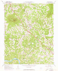
1964 Map of Pinnacle
USGS Topo · Published 1973About this map
Pilot Mountain and the surrounding terrain of the Pilot Mountain State Park dominate this mid-1960s landscape, where the Southern railroad line cuts a direct path through the Piedmont towards the Yadkin River. The village of Pinnacle serves as a local hub, featuring the Pinnacle Sch and nearby Mt Moriah Ch. To the southeast, the terrain transitions into the winding drainage basins of the Little Yadkin River and Crooked Run, where rural life is anchored by family-named landmarks such as the Wall Cem and Gilliam Cem. The presence of several churches, including Friends Union Ch and Mount Pleasant Ch, alongside various small cemeteries, reflects a deeply rooted community structure. This survey documents the area just as aerial updates began to track changes in the local infrastructure, including the emergence of the Pilot Knob Golf Club and industrial additions like a Substation.
Find a feature on this map
45 named features on this map. Tap any name to fly to it.
Don’t see what you’re looking for? This feature index may not catch every label — zoom into the map to look around manually.
Map Details
Editions of this 1964 Pinnacle Map
4 editions found
Other maps of this area

1891 · Yadkinville
USGS Topo · 1:125,000

1893 · Yadkinville
USGS Topo · 1:125,000

1951 · Rural Hall
USGS Topo · 1:24,000

1953 · Winston-Salem
USGS Topo · 1:250,000

1955 · Winston-Salem
USGS Topo · 1:250,000

1962 · Winston-Salem
USGS Topo · 1:250,000

1964 · Hanging Rock
USGS Topo · 1:24,000

1964 · Pinnacle
USGS Topo · 1:24,000

1964 · King
USGS Topo · 1:24,000

1964 · Pilot Mountain
USGS Topo · 1:24,000