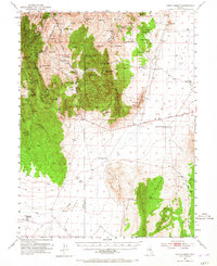
1953 Map of Pinto Summit
USGS Topo · Published 1965About this map
The Lincoln Highway cuts across the arid basin of Newark Valley in this survey of the high desert along the Eureka Co White Pine Co line. The map captures a landscape defined by 19th-century mining heritage and remote ranching outposts. Clustered near Pinto Summit, a dense network of silver and lead operations like the Bullwhacker Mine, Eldorado Tunnel, and Windfall Mine reveal the intensive subterranean activity that once drove the local economy.
Find a feature on this map
90 named features on this map. Tap any name to fly to it.
Don’t see what you’re looking for? This feature index may not catch every label — zoom into the map to look around manually.
Map Details
Editions of this 1953 Pinto Summit Map
4 editions found
Other maps of this area

1926 · Roberts Mountains
USGS Topo · 1:250,000

1929 · Roberts Mountains
USGS Topo · 1:250,000

1951 · Green Springs
USGS Topo · 1:62,500

1951 · Pancake Summit
USGS Topo · 1:62,500

1953 · Pinto Summit
USGS Topo · 1:62,500

1953 · Eureka
USGS Topo · 1:62,500

1955 · Millett
USGS Topo · 1:250,000

1956 · Bellevue Peak
USGS Topo · 1:62,500

1956 · Cockalorum Wash
USGS Topo · 1:62,500

1956 · Whistler Mtn
USGS Topo · 1:62,500