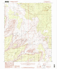
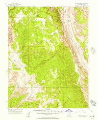
1987 Map of Pioneer Mesa
USGS Topo · Published 1987About this map
Circle Cliffs dominate this 1980s landscape in Garfield County, defining a region of dramatic verticality and complex drainage. The terrain is characterized by broad elevated benches, including King Bench and Big Bown Bench, which overlook deep-cut watercourses such as Wolverine Creek and the aptly named Death Hollow. These geographical features trace the erosion patterns of the high desert plateau, where the Wolverine Petrified Wood Natural Area marks a significant geologic site.
Find a feature on this map
15 named features on this map. Tap any name to fly to it.
Don’t see what you’re looking for? This feature index may not catch every label — zoom into the map to look around manually.
Map Details
Editions of this 1987 Pioneer Mesa Map
2 editions found
Other maps of this area

1886 · Escalante
USGS Topo · 1:250,000

1953 · Circle Cliffs 1 SE
USGS Topo · 1:24,000

1953 · Circle Cliffs 2 NE
USGS Topo · 1:24,000

1953 · Circle Cliffs 4 NW
USGS Topo · 1:24,000

1953 · Circle Cliffs 1 SW
USGS Topo · 1:24,000
1953 · Circle Cliffs 1 NW
USGS Topo · 1:24,000
1953 · Circle Cliffs 1 NE
USGS Topo · 1:24,000

1953 · Circle Cliffs 4 NE
USGS Topo · 1:24,000

1953 · Moody Creek
USGS Topo · 1:62,500
1953 · Wagon Box Mesa
USGS Topo · 1:62,500