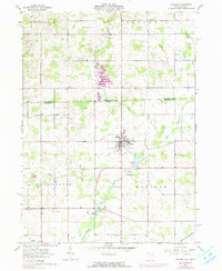
1961 Map of Pioneer
USGS Topo · Published 1990About this map
The Pioneer settlement serves as the focal point of this interstate border survey, situated where the Norfolk and Western railroad once cut through the corner of Madison township. The landscape is defined by the winding course of the West Branch St Joseph River and its tributaries, including Silver Creek and Clear Fork, which carve through the agricultural fields of northwest Ohio.
Find a feature on this map
28 named features on this map. Tap any name to fly to it.
Don’t see what you’re looking for? This feature index may not catch every label — zoom into the map to look around manually.
Map Details
Editions of this 1961 Pioneer Map
Other maps of this area

1913 · Alvordton
USGS Topo · 1:62,500

1914 · Pioneer
USGS Topo · 1:62,500

1944 · Pioneer
USGS Topo · 1:62,500

1944 · Alvordton
USGS Topo · 1:62,500

1953 · Fort Wayne
USGS Topo · 1:250,000

1956 · Fort Wayne
USGS Topo · 1:250,000

1959 · Reading
USGS Topo · 1:24,000

1959 · Frontier
USGS Topo · 1:24,000
1961 · Pioneer
USGS Topo · 1:24,000
1961 · West Unity
USGS Topo · 1:24,000