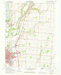
1961 Map of Piqua East
USGS Topo · Published 1973About this map
The Miami River and the Miami and Erie Canal (Abandoned) dominate this Western Ohio landscape, illustrating the evolution of transport from water to rail and road. The city of Piqua serves as the regional hub, showing a dense grid of streets and public institutions like the Armory, City Hall, and numerous neighborhood schools such as St Boniface Sch and Staunton St Sch. Outside the city, the land is marked by small settlements like Kirkwood and Garby, and the paths of the Baltimore and Ohio and Penn Central railroads. The rural sections are dotted with family history markers, including McKinney Cem and Garby Cem No 2. A notable engineering feature is the Miami Conservancy District (Lockington Reserve), which includes a spillway and dam designed for flood control near Lockington.
Find a feature on this map
62 named features on this map. Tap any name to fly to it.
Don’t see what you’re looking for? This feature index may not catch every label — zoom into the map to look around manually.
Map Details
Editions of this 1961 Piqua East Map
4 editions found
Other maps of this area

1909 · Loramie
USGS Topo · 1:62,500

1911 · Loramie
USGS Topo · 1:62,500

1911 · Covington
USGS Topo · 1:62,500

1913 · Sidney
USGS Topo · 1:62,500

1914 · Troy
USGS Topo · 1:62,500

1944 · Covington
USGS Topo · 1:62,500

1944 · Sidney
USGS Topo · 1:62,500

1944 · Loramie
USGS Topo · 1:62,500

1944 · Troy
USGS Topo · 1:62,500

1953 · Muncie
USGS Topo · 1:250,000