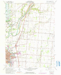
1961 Map of Piqua East
USGS Topo · Published 1990About this map
The industrial and transportation legacy of the Great Miami River valley is deeply etched into this 1960s-era survey. The city of Piqua serves as the focal point, showing a dense urban grid supported by the Penn Central Railroad and the Baltimore and Ohio Railroad. North of the city, the complex hydraulic history of the region is evident in the Miami and Erie Canal, including its abandoned segments and the feeder system near Lockington.
Find a feature on this map
98 named features on this map. Tap any name to fly to it.
Don’t see what you’re looking for? This feature index may not catch every label — zoom into the map to look around manually.
Map Details
Editions of this 1961 Piqua East Map
4 editions found
Other maps of this area

1909 · Loramie
USGS Topo · 1:62,500

1911 · Loramie
USGS Topo · 1:62,500

1911 · Covington
USGS Topo · 1:62,500

1913 · Sidney
USGS Topo · 1:62,500

1914 · Troy
USGS Topo · 1:62,500

1944 · Covington
USGS Topo · 1:62,500

1944 · Sidney
USGS Topo · 1:62,500

1944 · Loramie
USGS Topo · 1:62,500

1944 · Troy
USGS Topo · 1:62,500

1953 · Muncie
USGS Topo · 1:250,000