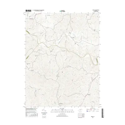
2016 Map of Piqua
USGS Topo · Published 2016About this map
Licking River meanders across the northern half of this landscape, carving a valley between the borders of Robertson, Harrison, and Nicholas Counties. The 2016 terrain is defined by a dense network of creek branches, including Painter Cr, Sugar Cr, and Stony Cr, which separate high ridges like Hoovers Ridge and Rose Hill. Small, long-standing settlements like Piqua, Kentontown, and Barterville serve as focal points for local history, each connected by a spiderweb of rural roads such as Old Maysville Rd and Crayton Creek Rd.
Find a feature on this map
76 named features on this map. Tap any name to fly to it.
Don’t see what you’re looking for? This feature index may not catch every label — zoom into the map to look around manually.
Map Details
Editions of this 2016 Piqua Map
This is the sole edition of this map. No revisions or reprints were ever made.
Other maps of this area

1915 · Maysville
USGS Topo · 1:62,500

1919 · Maysville
USGS Topo · 1:62,500

1952 · Cowan
USGS Topo · 1:24,000

1952 · Sardis
USGS Topo · 1:24,000

1952 · Mount Olivet
USGS Topo · 1:24,000

1952 · Piqua
USGS Topo · 1:24,000

1952 · Shady Nook
USGS Topo · 1:24,000

1952 · Claysville
USGS Topo · 1:24,000

1953 · Carlisle
USGS Topo · 1:24,000

1953 · Moorefield
USGS Topo · 1:24,000