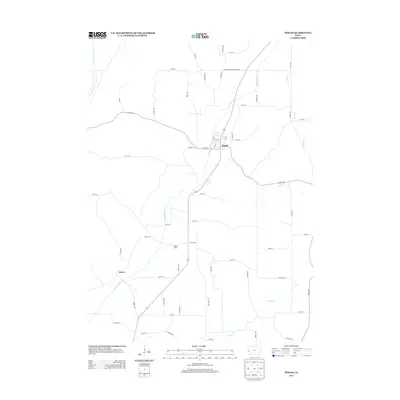
2013 Map of Pisgah
USGS Topo · Published 2013About this map
Pisgah serves as the primary population center in this western Iowa landscape, where the Soldier River carves a path through the rolling Loess Hills region. The town is structured around a grid of residential streets like Oak St and Park St, positioned where Highway 183 meets the river's course. The surrounding countryside is defined by agricultural tracts and a network of secondary roads, including the Harrison Monona Co Line Rd, which marks the northern boundary of the quadrangle.
Find a feature on this map
61 named features on this map. Tap any name to fly to it.
Don’t see what you’re looking for? This feature index may not catch every label — zoom into the map to look around manually.
Map Details
Editions of this 2013 Pisgah Map
This is the sole edition of this map. No revisions or reprints were ever made.
Other maps of this area

1954 · Omaha
USGS Topo · 1:250,000

1955 · Fremont
USGS Topo · 1:250,000

1957 · Fremont
USGS Topo · 1:250,000

1957 · Omaha
USGS Topo · 1:250,000

1958 · Omaha
USGS Topo · 1:250,000

1958 · Fremont
USGS Topo · 1:250,000

1970 · Little Sioux
USGS Topo · 1:24,000
1970 · Blencoe
USGS Topo · 1:24,000

1970 · Logan
USGS Topo · 1:24,000

1970 · Mondamin
USGS Topo · 1:24,000