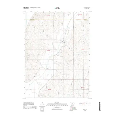
2018 Map of Pisgah
USGS Topo · Published 2018About this map
Pisgah and the surrounding Loess Hills of Harrison and Monona counties are defined by the winding course of the Soldier River and its numerous tributaries. This agricultural landscape in western Iowa is surveyed at a point when the rural grid remains largely intact, punctuated by historic burial grounds like Soldier Valley Cem and Fountainbleau Cem. The terrain is deeply carved, with drainage systems like Cobb Cr and Steer Cr cutting through the bluffs east of the Little Sioux River floodplain.
Find a feature on this map
66 named features on this map. Tap any name to fly to it.
Don’t see what you’re looking for? This feature index may not catch every label — zoom into the map to look around manually.
Map Details
Editions of this 2018 Pisgah Map
This is the sole edition of this map. No revisions or reprints were ever made.
Other maps of this area

1954 · Omaha
USGS Topo · 1:250,000

1955 · Fremont
USGS Topo · 1:250,000

1957 · Fremont
USGS Topo · 1:250,000

1957 · Omaha
USGS Topo · 1:250,000

1958 · Omaha
USGS Topo · 1:250,000

1958 · Fremont
USGS Topo · 1:250,000

1970 · Little Sioux
USGS Topo · 1:24,000
1970 · Blencoe
USGS Topo · 1:24,000

1970 · Logan
USGS Topo · 1:24,000

1970 · Mondamin
USGS Topo · 1:24,000