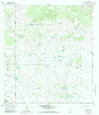
1956 Map of Pita Camp
USGS Topo · Published 1983About this map
The boundary between Brooks Co and Kenedy Co divides this ranching landscape of Deep South Texas, where water management is the primary marker of human activity. The 1950s survey reveals a territory defined by isolated cattle operations like Ball Ranch and the centralized Pita Camp. Because surface water is scarce, the map identifies a dense network of vital hydraulic features, including the Cerrito Artesian Well, Lindero Artesian Well, and Senorita Artesian Well.
Find a feature on this map
26 named features on this map. Tap any name to fly to it.
Don’t see what you’re looking for? This feature index may not catch every label — zoom into the map to look around manually.
Map Details
Editions of this 1956 Pita Camp Map
2 editions found
Other maps of this area

1921 · Falfurrias
USGS Topo · 1:125,000

1923 · Armstrong
USGS Topo · 1:62,500

1928 · Sarita
USGS Topo · 1:125,000

1949 · Mc Allen
USGS Topo · 1:250,000

1950 · Corpus Christi
USGS Topo · 1:250,000

1953 · Brownsville
USGS Topo · 1:250,000

1954 · McAllen
USGS Topo · 1:250,000

1954 · Sarita
USGS Topo · 1:62,500

1956 · Corpus Christi
USGS Topo · 1:250,000

1956 · Pita Camp
USGS Topo · 1:24,000