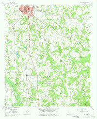
1960 Map of Pittsburg
USGS Topo · Published 1975About this map
Pittsburg serves as the primary hub of activity in this Northeast Texas landscape, where the St Louis Southwestern RR bisects the town's dense residential grid. The 1960 field-checked data highlights a decentralized network of rural faith and education, with numerous country churches like Union Chapel, Crossroads Ch, and Pine Ch serving the surrounding farmsteads. To the south, the landscape is defined by the Camp Co / Upshur Co boundary and a series of creek branches, including Prairie Creek and Darby Creek, which drain the rolling terrain.
Find a feature on this map
49 named features on this map. Tap any name to fly to it.
Don’t see what you’re looking for? This feature index may not catch every label — zoom into the map to look around manually.
Map Details
Editions of this 1960 Pittsburg Map
2 editions found
Other maps of this area

1953 · Texarkana
USGS Topo · 1:250,000

1956 · Texarkana
USGS Topo · 1:250,000

1956 · Tyler
USGS Topo · 1:250,000

1960 · Bettie
USGS Topo · 1:24,000

1960 · Thomas
USGS Topo · 1:24,000

1960 · Leesburg
USGS Topo · 1:24,000

1960 · Coffeeville
USGS Topo · 1:24,000

1960 · La Fayette
USGS Topo · 1:24,000

1960 · Pittsburg
USGS Topo · 1:24,000

1964 · Harvard
USGS Topo · 1:24,000