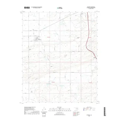
2018 Map of Pittsburg
USGS Topo · Published 2018About this map
Pittsburg serves as the central hub of this northern Ouachita mountain landscape, with its residential grid structured around Grand Ave and Pittsburg Ave. This modern survey reveals a region defined by sharp topographic contrasts, where the linear crest of Limestone Ridge and the heights of Pine Mtn frame the deep drainage of Pounds Valley. The local heritage is preserved in a high concentration of rural burial sites, including the Calvary Cem and Pittsburg Cem just north of town, alongside the Pleasant Valley Cem and Union Chapel Cem to the south. Modern infrastructure like the Indian Nation Tpke cuts through the eastern terrain near Brush Narrows, while numerous reservoirs such as Storrie Lake and the Burshy Peaceable Cr Site 16 Reservoir illustrate contemporary water management across the winding Brushy Creek watershed.
Find a feature on this map
55 named features on this map. Tap any name to fly to it.
Don’t see what you’re looking for? This feature index may not catch every label — zoom into the map to look around manually.
Map Details
Editions of this 2018 Pittsburg Map
This is the sole edition of this map. No revisions or reprints were ever made.
Other maps of this area

1898 · McAlester
USGS Topo · 1:125,000

1909 · Mc Alester
USGS Topo · 1:125,000

1950 · Mcalester
USGS Topo · 1:250,000

1957 · Limestone Gap
USGS Topo · 1:24,000

1962 · McAlester
USGS Topo · 1:250,000

1965 · McAlester
USGS Topo · 1:250,000

1967 · Pittsburg
USGS Topo · 1:24,000
1967 · Mc Alester SW
USGS Topo · 1:24,000
1967 · Kiowa
USGS Topo · 1:24,000

1967 · Hartshorne SW
USGS Topo · 1:24,000