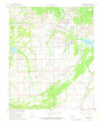
1967 Map of Mc Alester SW
USGS Topo · Published 1968About this map
The U.S. Naval Ammunition Depot dominates the landscape of this portion of Pittsburg County, its sprawling footprint defined by an extensive grid of service roads and specialized infrastructure. Established during World War II, the depot's presence is marked by the U.S. Government Railroad and the Stanton Railroad, which link the facility to broader networks like the Missouri - Kansas - Texas line. The geometric precision of the military installation contrasts sharply with the natural drainage of Boggy Creek and the localized topography of Whisky Knob and Big Prairie Ridge.
Find a feature on this map
30 named features on this map. Tap any name to fly to it.
Don’t see what you’re looking for? This feature index may not catch every label — zoom into the map to look around manually.
Map Details
Editions of this 1967 Mc Alester SW Map
3 editions found

Other maps of this area

1896 · Coalgate
USGS Topo · 1:125,000

1898 · McAlester
USGS Topo · 1:125,000

1899 · Coalgate
USGS Topo · 1:125,000

1900 · Coalgate
USGS Topo · 1:125,000

1909 · Mc Alester
USGS Topo · 1:125,000

1950 · Mcalester
USGS Topo · 1:250,000

1957 · Ardmore
USGS Topo · 1:250,000

1962 · McAlester
USGS Topo · 1:250,000

1963 · Ardmore
USGS Topo · 1:250,000

1965 · McAlester
USGS Topo · 1:250,000