
1967 Map of Hartshorne SW
USGS Topo · Published 1968About this map
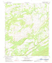
Peaceable Creek and its many tributaries, including Brier Creek and Wolf Creek, carve through this section of the Choctaw Nation's traditional territory during the late 1960s. The landscape is defined by the prominent uplift of Limestone Ridge and the steep slopes of New State Mountain to the south. Small rural communities and gathering places are scattered throughout the hills, marked by High Hill Ch and Peaceable Valley Ch.
Find a feature on this map
28 named features on this map. Tap any name to fly to it.
Don’t see what you’re looking for? This feature index may not catch every label — zoom into the map to look around manually.
Map Details
Editions of this 1967 Hartshorne SW Map
2 editions found
Other maps of this area

1898 · McAlester
USGS Topo · 1:125,000

1909 · Mc Alester
USGS Topo · 1:125,000

1950 · Mcalester
USGS Topo · 1:250,000

1962 · McAlester
USGS Topo · 1:250,000

1965 · McAlester
USGS Topo · 1:250,000

1967 · Pittsburg
USGS Topo · 1:24,000

1967 · Krebs
USGS Topo · 1:24,000
1967 · Mc Alester
USGS Topo · 1:24,000
1967 · Adamson
USGS Topo · 1:24,000
1967 · Savanna
USGS Topo · 1:24,000