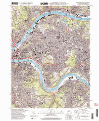
1997 Map of Pittsburgh East
USGS Topo · Published 2000About this map
The Monongahela River and Allegheny River converge toward the golden triangle, defining the industrial and civic heart of the city during the late 1990s. This sheet captures a landscape of intense density, where the Penn Central RR and B & O RR navigate the tight riverbanks and valleys that shaped the region’s growth. Major academic institutions, including the Univ of Pittsburgh and Carnegie-Mellon University, anchor the Oakland district, while vast green spaces like Schenley Park and Frick Park provide significant breaks in the urban fabric.
Find a feature on this map
125 named features on this map. Tap any name to fly to it.
Don’t see what you’re looking for? This feature index may not catch every label — zoom into the map to look around manually.
Map Details
Editions of this 1997 Pittsburgh East Map
2 editions found
Other maps of this area

1904 · Mc Keesport
USGS Topo · 1:62,500

1904 · Carnegie
USGS Topo · 1:62,500

1906 · Carnegie
USGS Topo · 1:62,500

1906 · Sewickley
USGS Topo · 1:62,500

1907 · Pittsburg
USGS Topo · 1:62,500

1908 · Sewickley
USGS Topo · 1:62,500

1908 · Carnegie
USGS Topo · 1:62,500

1908 · New Kensington
USGS Topo · 1:62,500

1910 · New Kensington
USGS Topo · 1:62,500

1948 · Pittsburgh West
USGS Topo · 1:24,000