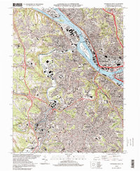
1997 Map of Pittsburgh West
USGS Topo · Published 1998About this map
Ohio River industrial corridors and the convergence of the Allegheny River and Monongahela River dominate this late-twentieth-century landscape. The Golden Triangle and Point State Park mark the geographic heart of the city, while the surrounding topography is defined by established boroughs like Mc Kees Rocks, Crafton, and Carnegie. The western bank of the river reveals a complex infrastructure of transport and utility, including the State Penitentiary and the large industrial footprint on Brunot Island.
Find a feature on this map
98 named features on this map. Tap any name to fly to it.
Don’t see what you’re looking for? This feature index may not catch every label — zoom into the map to look around manually.
Map Details
Editions of this 1997 Pittsburgh West Map
2 editions found
Other maps of this area

1904 · Mc Keesport
USGS Topo · 1:62,500

1904 · Carnegie
USGS Topo · 1:62,500

1906 · Carnegie
USGS Topo · 1:62,500

1906 · Sewickley
USGS Topo · 1:62,500

1907 · Pittsburg
USGS Topo · 1:62,500

1908 · Sewickley
USGS Topo · 1:62,500

1908 · Carnegie
USGS Topo · 1:62,500

1908 · New Kensington
USGS Topo · 1:62,500

1910 · New Kensington
USGS Topo · 1:62,500

1948 · Pittsburgh West
USGS Topo · 1:24,000