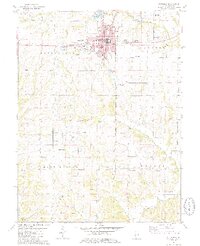
1981 Map of Pittsfield
USGS Topo · Published 1981About this map
Pittsfield serves as the central hub for this portion of Pike County, surrounded by the townships of Pittsfield, Newburg, Martinsburg, and Hardin. The landscape is defined by the drainage systems of Panther Creek, Honey Creek, and Buckeye Creek, which carve through the terrain south of Pine Lake. Notable civic landmarks within the seat include the Illini Hosp and several schools, while the outlying areas are dotted with numerous family and community burial grounds such as Oakwood Cem, Tamsett Cem, and Goodin Cem.
Find a feature on this map
38 named features on this map. Tap any name to fly to it.
Don’t see what you’re looking for? This feature index may not catch every label — zoom into the map to look around manually.
Map Details
Editions of this 1981 Pittsfield Map
2 editions found
Other maps of this area

1924 · Griggsville
USGS Topo · 1:62,500

1926 · Griggsville
USGS Topo · 1:62,500

1926 · Pittsfield
USGS Topo · 1:62,500

1930 · Pearl
USGS Topo · 1:62,500

1930 · Nebo
USGS Topo · 1:62,500

1934 · Nebo
USGS Topo · 1:48,000

1942 · Nebo
USGS Topo · 1:62,500

1948 · Quincy
USGS Topo · 1:250,000

1950 · Pearl
USGS Topo · 1:62,500

1956 · Quincy
USGS Topo · 1:250,000