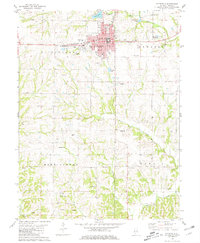
1981 Map of Pittsfield SE
USGS Topo · Published 1981About this map
The county seat of Pittsfield dominates the northern landscape of this survey, organized around a dense street grid that includes King Park and Lowry Park. The Norfolk and Western railroad line cuts through the heart of the settlement, serving local commerce and the grain elevators near the Pittsfield West Station. Education and healthcare infrastructure are concentrated here, featuring the Higbee Jr High Sch and Illini Hosp complex.
Find a feature on this map
37 named features on this map. Tap any name to fly to it.
Don’t see what you’re looking for? This feature index may not catch every label — zoom into the map to look around manually.
Map Details
Editions of this 1981 Pittsfield SE Map
2 editions found
Other maps of this area

1924 · Griggsville
USGS Topo · 1:62,500

1926 · Griggsville
USGS Topo · 1:62,500

1926 · Pittsfield
USGS Topo · 1:62,500

1930 · Pearl
USGS Topo · 1:62,500

1930 · Nebo
USGS Topo · 1:62,500

1934 · Nebo
USGS Topo · 1:48,000

1942 · Nebo
USGS Topo · 1:62,500

1948 · Quincy
USGS Topo · 1:250,000

1950 · Pearl
USGS Topo · 1:62,500

1956 · Quincy
USGS Topo · 1:250,000