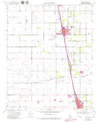
1954 Map of Pixley
USGS Topo · Published 1979About this map
Pixley and Earlimart anchor this agricultural landscape in Tulare County during the mid-20th century, revealing the expansion of these Central Valley communities along the Southern Pacific railroad corridor. Significant revisions based on 1969 aerial photography highlight urban growth in purple, particularly around the Pixley Union Sch and the southern reach of town near Deer Creek. The map shows a transition from intensive farming to conservation, with a large portion of the western territory dedicated to the Pixley National Wildlife Refuge. Local industry and infrastructure are represented by features like the Clay Pit, Gravel Pit, and Harmon Field. The intricate network of irrigation wells and reservoirs illustrates the heavy reliance on groundwater for the region's productivity during this era of development.
Find a feature on this map
16 named features on this map. Tap any name to fly to it.
Don’t see what you’re looking for? This feature index may not catch every label — zoom into the map to look around manually.
Map Details
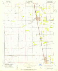
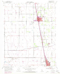
Editions of this 1954 Pixley Map
3 editions found
Other maps of this area

1925 · Tipton
USGS Topo · 1:31,680

1927 · Lake View School
USGS Topo · 1:31,680

1928 · Tipton
USGS Topo · 1:31,680

1928 · Woodville
USGS Topo · 1:31,680

1929 · Alpaugh
USGS Topo · 1:31,680

1929 · Delano
USGS Topo · 1:31,680

1929 · Sausalito School
USGS Topo · 1:31,680

1929 · Pixley
USGS Topo · 1:31,680

1929 · Stone
USGS Topo · 1:31,680

1929 · Allensworth
USGS Topo · 1:31,680