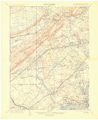
1905 Map of Plainfield
USGS Topo · Published 1915About this map
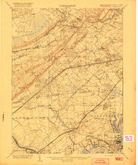
Great Swamp and the Passaic River dominate the northern landscape of this region, which was captured during a period of significant suburban and industrial expansion at the turn of the century. The map reveals an intricate network of competing rail lines, including the Delaware Lackawanna & Western RR and the Lehigh Valley RR, which facilitated the growth of towns like Summit and Cranford. Notable landmarks like Washington Rock overlook the developing corridor, while the southern reaches show the industrial character of the Arthur Kill and the Perth Amboy Branch. Genealogists will find interest in the transition of older settlements such as Connecticut Farms and New Orange. The presence of several specialized lines, including the Gravel RR and the N.J. Clay and Brick Co. RR, highlights the local extraction and manufacturing economies that thrived alongside the expanding residential commuter hubs.
Find a feature on this map
134 named features on this map. Tap any name to fly to it.
Don’t see what you’re looking for? This feature index may not catch every label — zoom into the map to look around manually.
Map Details
Editions of this 1905 Plainfield Map
6 editions found
Other maps of this area

1888 · Plainfield
USGS Topo · 1:62,500

1888 · Morristown
USGS Topo · 1:62,500

1888 · New Brunswick
USGS Topo · 1:62,500

1888 · Princeton
USGS Topo · 1:62,500

1888 · Lake Hopatcong
USGS Topo · 1:62,500

1888 · Paterson
USGS Topo · 1:62,500

1888 · Sandy Hook
USGS Topo · 1:62,500

1891 · Somerville
USGS Topo · 1:62,500

1892 · Paterson
USGS Topo · 1:62,500

1893 · New Brunswick
USGS Topo · 1:62,500