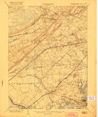
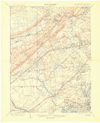
1905 Map of Plainfield
USGS Topo · Published 1920About this map
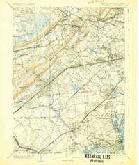
The Great Swamp and the prominent ridges of First Mountain and Second Mountain define the topography of this early 20th-century corridor between the Passaic River and the Raritan River. The map captures a critical era of transit-oriented development where the Central Railroad of New Jersey and Lehigh Valley Railroad intersect thriving townships. Industrial and maritime activity is concentrated along the Arthur Kill, while the inland areas show a dense network of suburbanizing settlements like Scotch Plains, Metuchen, and Bound Brook. Notable landmarks such as Washington Rock overlook the spreading grid of North Plainfield, providing a snapshot of the region before the massive post-war expansion of the New York metropolitan area. This survey, based on work from the late 1880s with culture updated at the turn of the century, preserves the original footprints of local names like Smalleytown, Pumptown, and Samptown.
Find a feature on this map
150 named features on this map. Tap any name to fly to it.
Don’t see what you’re looking for? This feature index may not catch every label — zoom into the map to look around manually.
Map Details
Editions of this 1905 Plainfield Map
6 editions found
Other maps of this area

1888 · Plainfield
USGS Topo · 1:62,500

1888 · Morristown
USGS Topo · 1:62,500

1888 · New Brunswick
USGS Topo · 1:62,500

1888 · Princeton
USGS Topo · 1:62,500

1888 · Lake Hopatcong
USGS Topo · 1:62,500

1888 · Paterson
USGS Topo · 1:62,500

1888 · Sandy Hook
USGS Topo · 1:62,500

1891 · Somerville
USGS Topo · 1:62,500

1892 · Paterson
USGS Topo · 1:62,500

1893 · New Brunswick
USGS Topo · 1:62,500