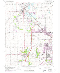
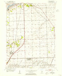
1962 Map of Plainfield
USGS Topo · Published 1974About this map
Plainfield and the neighboring industrial hubs of Joliet and Crest Hill emerge from this mid-century landscape as the region transitions from its agrarian roots toward a dense suburban and manufacturing corridor. The Elgin Joliet and Eastern railroad serves as a structural spine, linking numerous Gravel Pits and industrial zones to the broader commerce of Will County. This era is defined by the expansion of urban boundaries, highlighted in purple, extending from the established residential cores toward the historic Treaty Boundary and Caton Farm. Local life is anchored by institutional landmarks such as St Marys School, Troy School, and the Joliet Municipal Stadium. The map also captures the natural and recreational character of the area, featuring Lake Renwick, Legion Lake, and the wooded terrain of Hammel Woods along the Du Page River, providing a comprehensive view of the community's development before further modern sprawl.
Find a feature on this map
50 named features on this map. Tap any name to fly to it.
Don’t see what you’re looking for? This feature index may not catch every label — zoom into the map to look around manually.
Map Details
Editions of this 1962 Plainfield Map
3 editions found
Other maps of this area

1892 · Morris
USGS Topo · 1:62,500

1892 · Joliet
USGS Topo · 1:62,500

1892 · Wilmington
USGS Topo · 1:62,500

1918 · Wilmington
USGS Topo · 1:62,500

1918 · Morris
USGS Topo · 1:62,500

1923 · Joliet
USGS Topo · 1:62,500

1925 · Yorkville
USGS Topo · 1:62,500

1953 · Yorkville SE
USGS Topo · 1:24,000
1953 · Normantown
USGS Topo · 1:24,000
1953 · Elwood
USGS Topo · 1:24,000