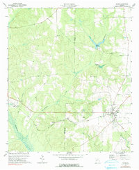
1973 Map of Plains
USGS Topo · Published 1991About this map
The Seaboard Coast Line railroad bisects this rural landscape, connecting the agricultural hubs of Plains and Archery during the early 1970s. The topography is defined by a dense network of tributaries including Lana hassee Creek and Choctahatchee Creek, which feed into the wetlands of Youngs Millpond. Settlement patterns follow the higher ground between these drainages, marked by a high concentration of community centers such as St Marks Ch, Mt Zion Ch, and the West Side Sch. Genealogists will find significant value in the numerous burial grounds documented across the county line between Webster and Sumter counties, including Lebanon Cem and Mt Avery Cem. The area around Plains shows its established infrastructure with identified Water Tanks and a High Sch, while the outlying Dumas serves as a smaller node of activity near Roadside Park.
Find a feature on this map
28 named features on this map. Tap any name to fly to it.
Don’t see what you’re looking for? This feature index may not catch every label — zoom into the map to look around manually.
Map Details
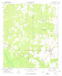
Editions of this 1973 Plains Map
2 editions found
Other maps of this area

1953 · Dothan
USGS Topo · 1:250,000

1954 · Dothan
USGS Topo · 1:250,000

1955 · Dothan
USGS Topo · 1:250,000

1955 · Phenix City
USGS Topo · 1:250,000

1957 · Phenix City
USGS Topo · 1:250,000

1958 · Phenix City
USGS Topo · 1:250,000
1972 · Preston
USGS Topo · 1:24,000

1972 · Parrott
USGS Topo · 1:24,000

1972 · Ellaville South
USGS Topo · 1:24,000
1973 · Church Hill
USGS Topo · 1:24,000