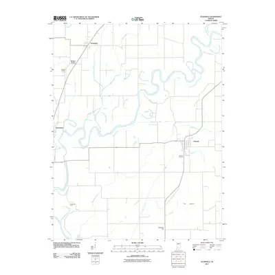
2011 Map of Plainville
USGS Topo · Published 2011About this map
The White River winds through this southwestern Indiana landscape, defining a complex network of agricultural drainage and flood control as recorded in 2011. The town of Plainville sits on the eastern edge of the quadrangle, where Hanna Creek and Smothers Creek converge. To the west, the river's influence is seen in the Bennington Levee and the artificial paths of the Killion Canal and Smothers Creek Cutoff.
Find a feature on this map
20 named features on this map. Tap any name to fly to it.
Don’t see what you’re looking for? This feature index may not catch every label — zoom into the map to look around manually.
Map Details
Editions of this 2011 Plainville Map
This is the sole edition of this map. No revisions or reprints were ever made.
Other maps of this area

1943 · Lyons
USGS Topo · 1:24,000

1943 · Sandborn
USGS Topo · 1:24,000

1943 · Bicknell
USGS Topo · 1:24,000

1943 · Plainville
USGS Topo · 1:24,000

1943 · Epsom
USGS Topo · 1:24,000

1944 · Bucktown
USGS Topo · 1:24,000

1944 · Montgomery
USGS Topo · 1:24,000

1944 · Washington
USGS Topo · 1:24,000

1944 · Wheatland
USGS Topo · 1:24,000

1956 · Vincennes
USGS Topo · 1:250,000