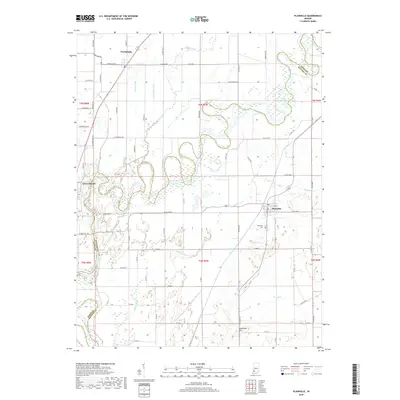
2019 Map of Plainville
USGS Topo · Published 2019About this map
Plainville and Westphalia anchor this portion of southwestern Indiana, where the White River carves a complex, meandering path across the border of Knox and Daviess counties. The landscape is defined by an extensive network of drainage and water management systems, including the Killion Canal, Pollard Ditch, and Linnewebber Ditch, which support the agricultural tracts between the river bends. To the south, Harbstreit Hill provides a rare point of elevation overlooking the low-lying basin of The Lagoon. This survey captures the rural infrastructure of the early 21st century, from the Plainville Cemetery to the engineered channel of the Smothers Creek Cutoff. The map clearly illustrates how the river's shifting course has necessitated a sophisticated system of canals and ditches to reclaim and manage the fertile bottomlands near Edwardsport.
Find a feature on this map
45 named features on this map. Tap any name to fly to it.
Don’t see what you’re looking for? This feature index may not catch every label — zoom into the map to look around manually.
Map Details
Editions of this 2019 Plainville Map
This is the sole edition of this map. No revisions or reprints were ever made.
Other maps of this area

1943 · Lyons
USGS Topo · 1:24,000

1943 · Sandborn
USGS Topo · 1:24,000

1943 · Bicknell
USGS Topo · 1:24,000

1943 · Plainville
USGS Topo · 1:24,000

1943 · Epsom
USGS Topo · 1:24,000

1944 · Bucktown
USGS Topo · 1:24,000

1944 · Montgomery
USGS Topo · 1:24,000

1944 · Washington
USGS Topo · 1:24,000

1944 · Wheatland
USGS Topo · 1:24,000

1956 · Vincennes
USGS Topo · 1:250,000